
We're so happy to be back in the tall pine/fur trees and mountains camping at 7,900' elevation about seven and a half miles west of Red River, NM.
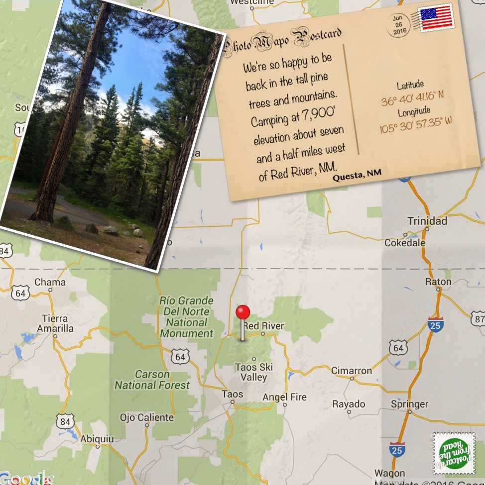
Columbine Campground - Forest Service Campground — Carson National Forest, near Questa, NM: Site #20 (27 RV sites total) - This site has: water nearby. Campground Notes: vault toilets • no dump station available • creek access • trails from campground • trails nearby • 7,900’ elevation. June 26th - July 5rd. Miles traveled: 204 (tap on mileage to see route).
Overall Experience:

This campground was a wonderful find for us. We have wanted to check out the Forest Service campgrounds in the Red River area for a long time. This one did not disappoint — for the most part, the sites are spacious, and the campground is well maintained, including the vault toilets. Our site is set back enough from the highway that the road noise is minimal.
The Columbine Creek flows through the campground, and the Columbine Trail follows the creek upstream from the campground. This 5.7-mile trail connects with other trails in the Carson National Forest and is part of the National Recreation Trail.
Hiking the Columbine Trail
Our intention on Tuesday was to do a nice hike on the Columbine trail that originates in our campground. We didn't get a quarter of a mile before it started to thunder and lightning – time to abort. After we got back to the coach, the rain and hail came in. When things calmed down, we went out for a short walk on the trail. We will try again on Wednesday.
 One of the four bridges on the lower part of the trail. The first three are these cool "V" bridges.
On Wednesday the weather was perfect, and we got to complete our hike on the Columbine trail — eight-plus miles round trip, and for us, we topped off at 9,850 elevation. There definitely was the option for a lot more miles, but we were happy with our distance.
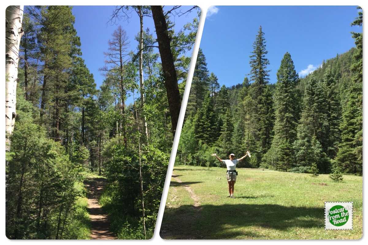 The trail starts out in the pine/fur trees following Columbine creek with occasional scenic meadows along the way. As the trail climbs, aspen trees become more plentiful. In the last part of our ascent, we were treated with a series of cascading falls — quite enjoyable.
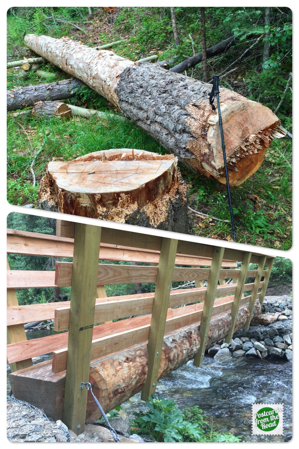 Top photo in the collage is a log being prepared for a new bridge. Since this is in a Wilderness area, all work must be done with hand tools. Note the hiking pole next to the log. *The bottom photo is a close-up of how the log is used for the bridge.
As we hike, the bridges transformed from those cool "V" shaped ones to logs across the creek. This is the fourth bridge on the lower section. After that, it's a lot of rock hopping and wet feet.
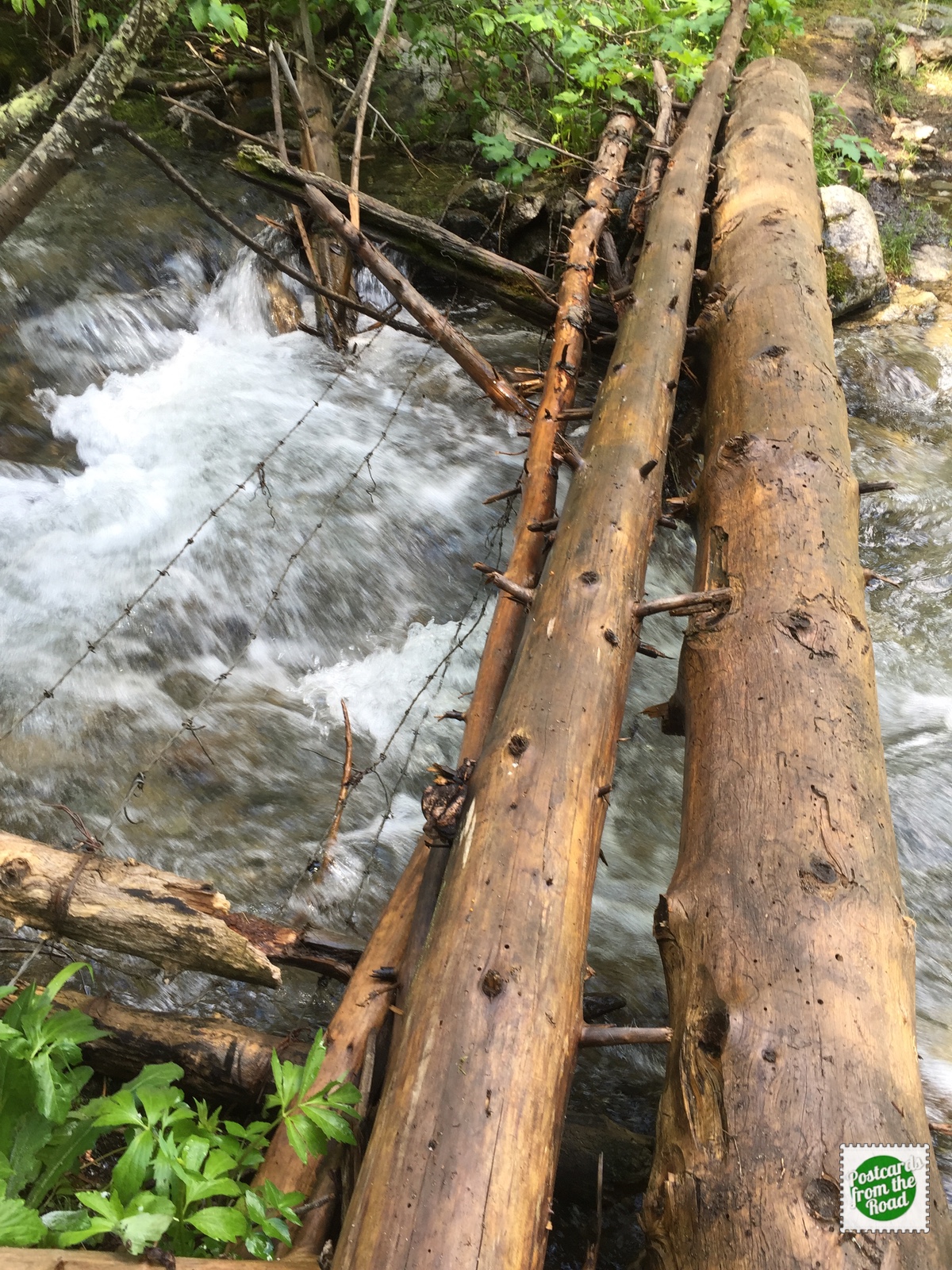 Gotta like this one, they have barbed wire to catch you in case you fall off.
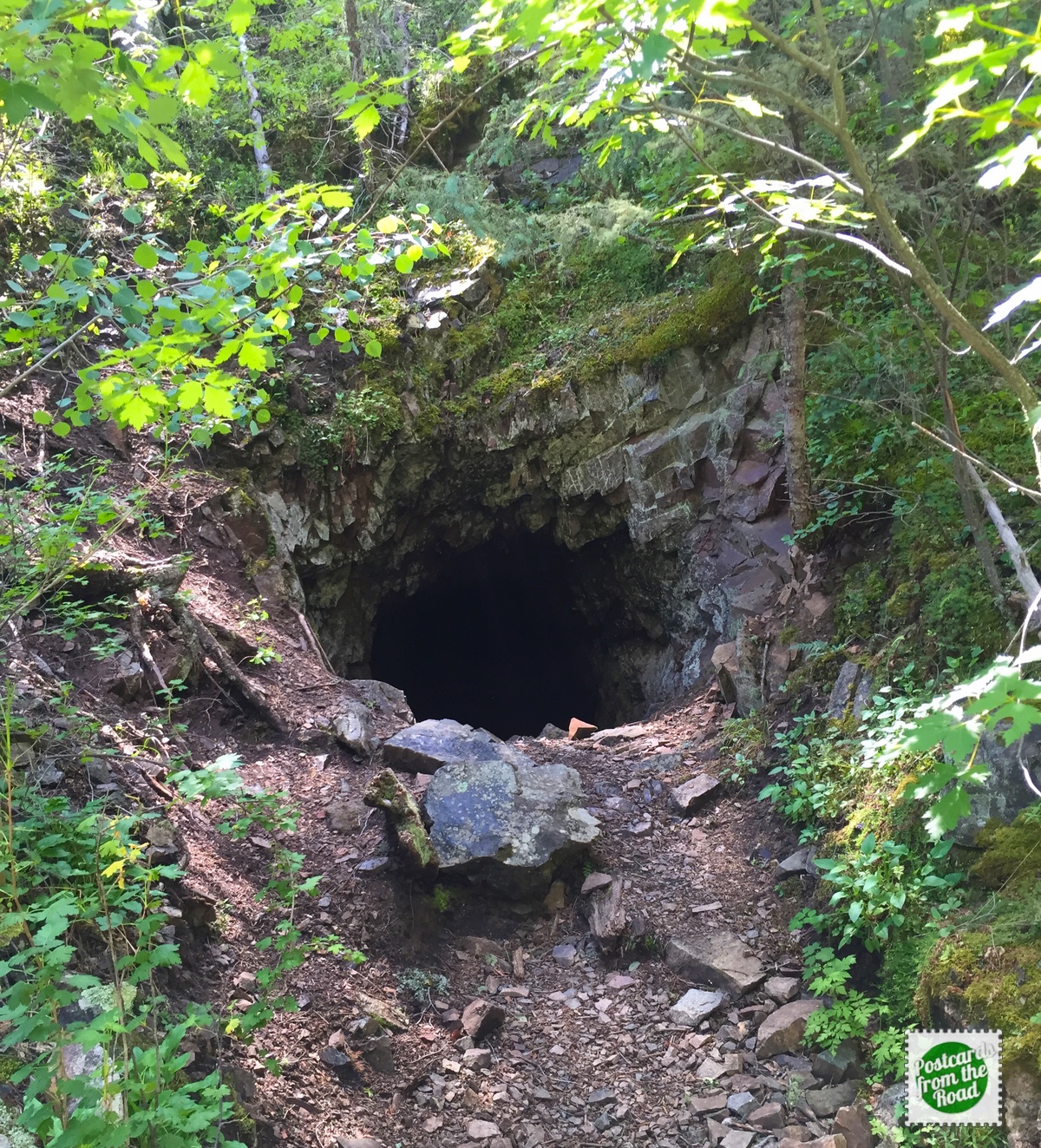 Mine entrance adjacent to the trail. We imagine that there are probably many more as the Columbine trail loosely follows a route used by early prospectors.
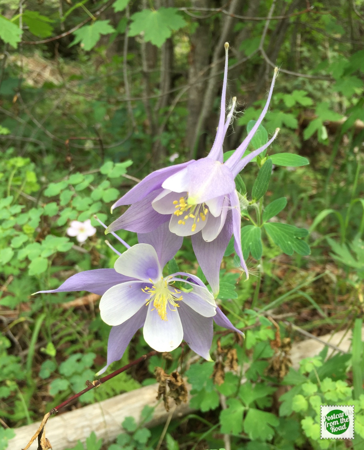 Columbine campground, Columbine Creek, Columbine trail, and finally saw some Columbine flowers. Perhaps Diana's favorite flower.
Local Flavor – Area Businesses We Enjoyed & Recommend
• Taos Mesa Brewing, El Prado, NM. Brewpub with outstanding beer, good food, and occasional live music. We make a point of stopping here when we pass through the area.
• The Burger Stand @ Taos Ale House, Taos, NM. Brewpub with small-batch handcrafted beer plus a nice selection of NM beers. Also serving delicious burgers & sandwiches. The Spicy Shiitake is a yummy veggie option!
